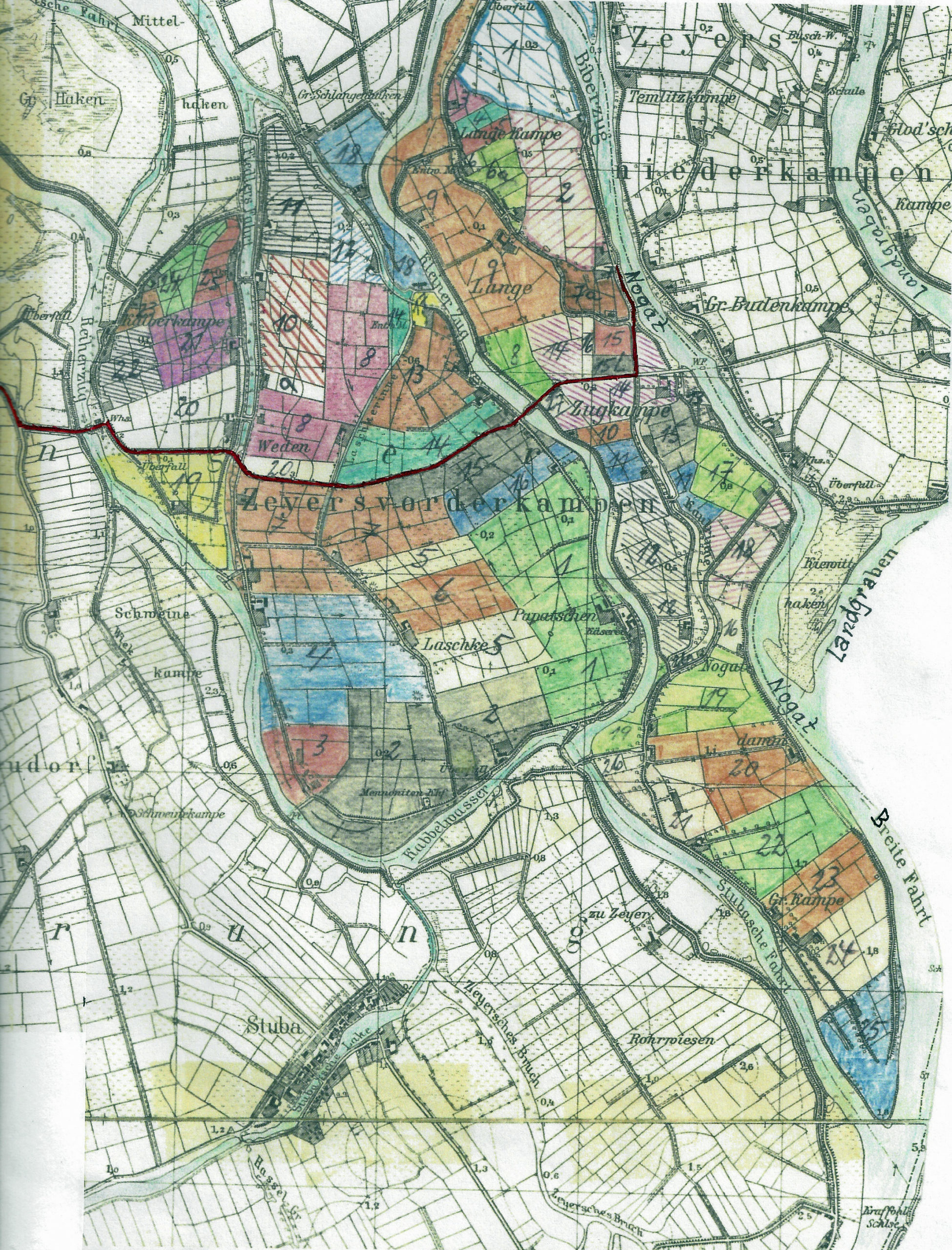
Zeyersvorderkampen (1945)
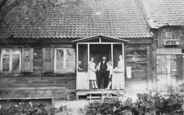
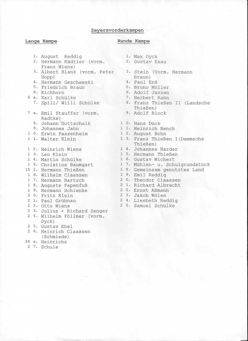
My opa’s (Richard Senger) farm (before 1947) was located in Zeyersvorderkampen Freie Stadt Danzig- Westpreußen (today: Kępiny Małe in North Central Poland). My oldest family friend Rainer Mueller-Glodde provided me with this map. My opa & great-onkel’s (Richard u. Julius Senger) farm was located at number 23 (bottom of the map on the right-hand side).
——— English Translated with www.DeepL.com/Translator (free version) ————-
In the Ordnance Survey sheet “1781 Jungfer”, 1 : 25,000, from 1936, the farms of Zeyersvorderkampen and their owners are shown here in color; status ca. 1940 / 1945.
The map was created by Gerhard Dyck, b: Einlage 1927, d: † 2003, based on the information of his father-in-law Johannes Richard Jahn, farm Lange Kampe No. 9, who as head of Zeyersvorderkampen was aware of the ownership. The date of creation of the map should be in the 2nd half of the 1950-ies.
Sent by Uwe Waldling – Forum.Danzig
[…]———Abbreviated Original —————–
In das Messtischblatt “1781 Jungfer”, 1 : 25.000, von 1936 sind hier die Höfe von Zeyersvorderkampen und ihrer Eigentümer farblich kenntlich gemacht; Stand ca. 1940 / 1945.
Die Karte wurde erstellt von Gerhard Dyck, * Einlage 1927, † 2003, auf der Basis der Informationen seines Schwiegervaters Johannes Richard Jahn, Hof Lange Kampe Nr. 9, dem als Amtsvorsteher von Zeyersvorderkampen die Besitzverhältnisse bekannt waren. Das Erstellungsdatum der Karte dürfte in der 2. Hälfte der 1950-er Jahre liegen.
Übersandt von Uwe Waldling – Forum.Danzig
[…]
Mark Rabideau
ManyRoads Creator, Professional Genealogist, Family Historian, power-walker, Old Guy and most importantly 'opa'