Maps (Cartography)
ManyRoads’ Cartography Area
Maps – Landkarten
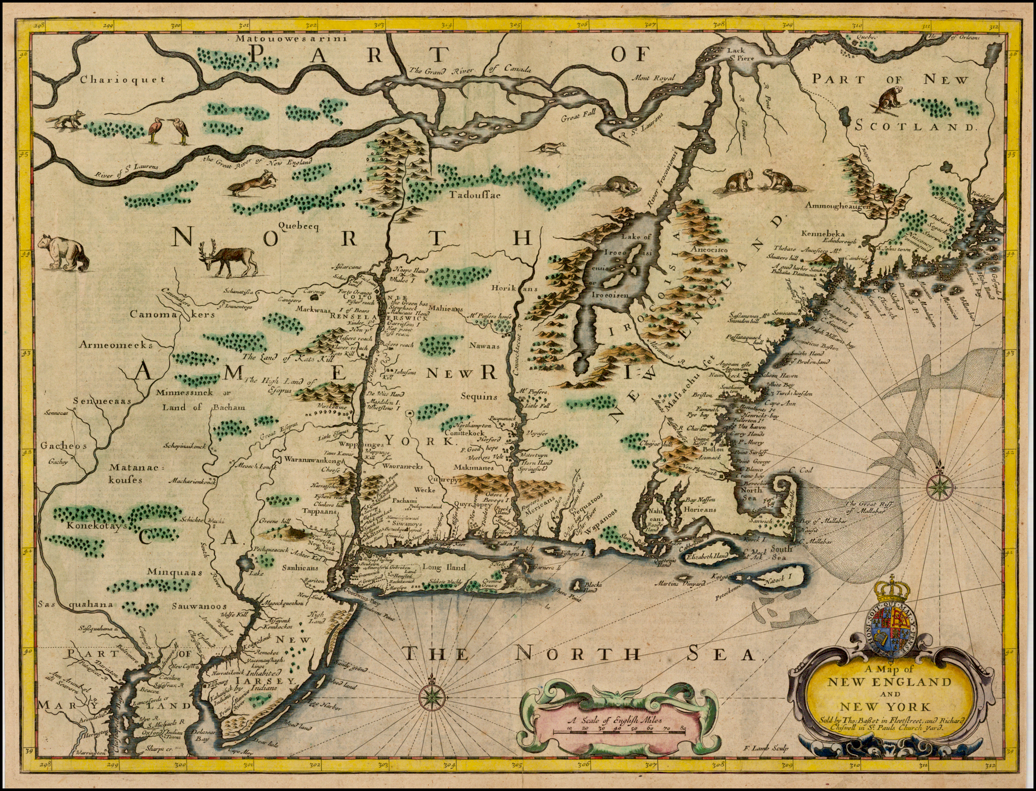
As in the past, ManyRoads is committed to providing access to a wide variety of downloadable ‘free’ maps. In this area, we offer nearly 500 Maps, many are quite ‘ancient’.
It is our strong belief that maps form an extremely useful bridge to understanding both the movement of peoples and groups as well as to the life styles and life options that were available in different times.
To quote the USGS (United States Geological Service)…
Maps are one of the many sources you may need to complete a family tree.
In genealogical research, maps often provide clues to where our ancestors may have lived and where to look for written records about them.
Beginners should master basic genealogical research techniques before starting to use topographic and historical maps.
ManyRoads' work and material is licensed under a: Creative Commons Attribution-NonCommercial-ShareAlike 4.0 International License.
- Personal use of these materials is encouraged and allowed without fee(s).
- Any instructional, commercial or professional use is only allowed with prior ManyRoads' approval. Contact us to get approval.
- For professional "personalized" research support, please visit our Services page.
ManyRoads’ Map Libraries

Do you benefit from our articles and resources?
Your support, through donation or affiliate usage, allows ManyRoads to remain online.